 |

|
100 Clayton Road
Raton, New Mexico 87740 (575) 445-3689
[email protected] |
Related Sites
City of Raton
Civic organizations, government, and schools
Philmont Scout Ranch
Santa Fe Trail
Members
Advertise your business here
Raton, New Mexico is located at the base of the Sangre de Cristo mountains of New Mexico, and the Rocky Mountains of Colorado. Breathtaking scenery, hiking, boating, fishing, and guided hunts, along with many historical sights on the Santa Fe Trail, make northeastern New Mexico one of the most popular places to visit.
Stay in Raton at one of the friendly, convenient motels, drive to one of the following destinations that are only a short driving distance away, and be back for an evening meal, a local movie, or possibly a night at the Shuler Theater.
More information about each site is available at the New Mexico Visitors' Center at the corner of Tiger Drive and Clayton Road on the I-25 business loop.
- Capulin Volcano National Monument
- Cimarron Canyon State Park
- Fort Union National Monument
- Goat Hill overlook
- NRA Whittington Center
- Sugarite Canyon State Park
Capulin Volcano National Monument
 Capulin Volcano National Monument protects and preserves a perfectly symmetrical volcanic crater, an outstanding example of an extinct cinder cone, one of three types of volcanoes in this central portion of the Raton/Clayton volcanic field. A visitor center has exhibits, bookstore and a video presentation located near the entrance. A two-mi. scenic road winds to the top. Trails are located at the visitor center, along crater rim, and into the 415' deep crater. Call (575)278-2201 for more information
Cimarron Canyon State Park
 Popular among trout fishermen and RV campers, this state park located 11 miles west of Cimarron, New Mexico, has 20 electric sites, and RV dump station and comfort station. The park stretches for 8 miles along the Cimarron River and includes hunting, winter sports and horseback riding. Part of the stunningly beautiful 33,000 acre Colin Neblett Wildlife Area, the Palisades of the Cimarron are a popular photo spot within the canyon.
Fort Union National Monument
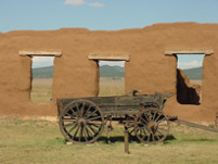 Remains of a star-shaped fort (1861-62) and adobe third fort (1863-91) form the bulk of the national monument. Fort Union was a principal supply post in the southwest, which provided escort and protection for travelers at west end of the Santa Fe Trail. Military supplies arriving at the Quartermaster Depot were stored and then transported to outer military posts by local contractors and military teamsters.
The visitor's center includes a gift shop and museum. A variety of activities are scheduled throughout the year, including re-enactments of military life at the fort. Fort Union was a major site along the Santa Fe Trail.
Goat Hill overlook
 The overlook offers a superlative panorama of the mesas to the east and Eagle Tail Peak and Wagon Mound to the south with a view of the city of Raton below. The view encompasses a 10 mi. portion of the Mountain Route of the Santa Fe Trail from its descent from 7,834' high Raton Pass through Raton west to Cimarron.
Traveling north from the overlook is the old Raton Pass along which is a site marked as one of the best locations to view the Iridium layer.
NRA Whittington Center
 Founded in 1973, the 33,000-acre facility is the largest and most complete shooting and hunting complex in the world, welcoming more than 100,000 visitors a year. Hunts, trap shooting, target practice ranges and other events are offered with access for handicapped gun enthusiasts. Open every day all year, it features lodging,meeting rooms and dining. This facility is located on the eastern slope of the Sangre de Cristo Mountains. A portion of the Mountain Route of the Santa Fe Trail (where trail ruts are visible) crosses the southern boundary of the facility which preserves the open space and feel of the trail in this region.
Sugarite Canyon State Park
 The park, near the north end of secluded Sugarite Canyon, contains historic exhibits, lakes, campsites and hiking trails. Summer weekend campfire programs. Old buildings and rock foundations of the Sugarite coal mining camp (1910-41) just inside the park entrance, can be toured. The Chicorica-San Francisco Pass parallels the northeast border of the Beaubien & Miranda (Maxwell) Land Grant. It formed an alternate route for the Jicarilla Apaches, Mouache Utes, traders, and trappers. Many homesteaders passed here on their way over Raton Pass. The state park contains a museum and several hiking trails with overlooks.